Here are five of Italy’s best hiking tracks... there’s something for everyone!
Sentiero Azzurro, Cinque Terre

Start: Riomaggiore
End: Monterosso
Length: 12 kilometres
Duration: three to four hours
Difficulty: easy-moderate
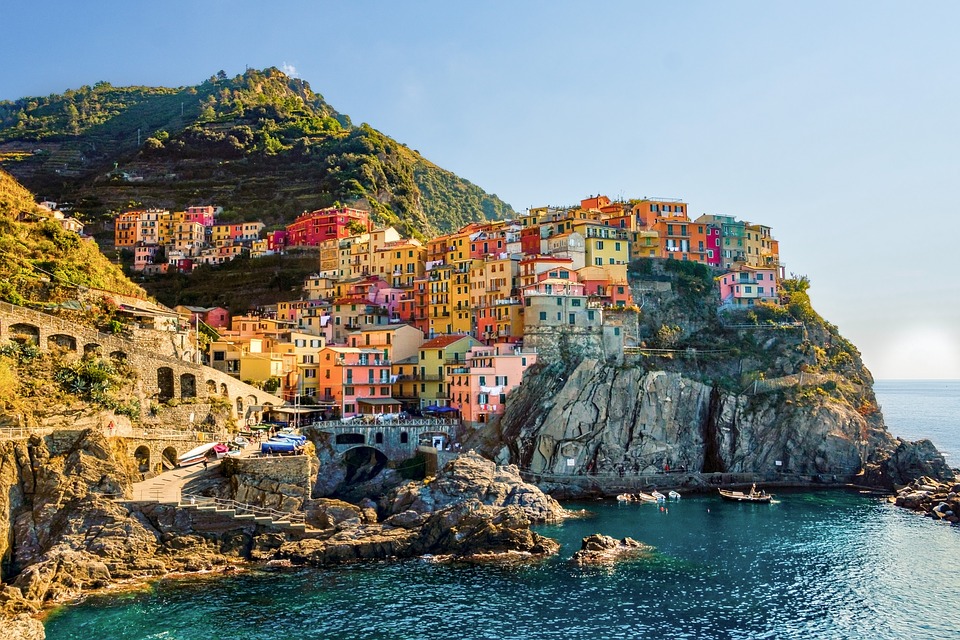
Cinque Terre... they’re two words which conjure up images of romantic fishing villages, pastel houses and a rugged coastline.
The Sentiero Azzurro, or Blue Trail, strings together each of the five seaside towns that make up Cinque Terre.
This cliff-side hiking trail offers unmatched views of vineyards, olive groves and terraced hillsides, and sweeping vistas of the sapphire sea below.
Made up of four paths between each village, the trail is best walked east to west, from Riomaggiore to Monterosso.
If you’re not up for doing the whole thing, you can walk as far as the middle village, Corniglia, and catch a train back.
Before you head off, make sure you purchase a ticket to the trail and check out current hiking conditions.
Tre Cime di Lavaredo, Dolomites

Start/End: Rifugio Auronzo
Length: nine and a half kilometres
Duration: three to four hours
Difficulty: moderate
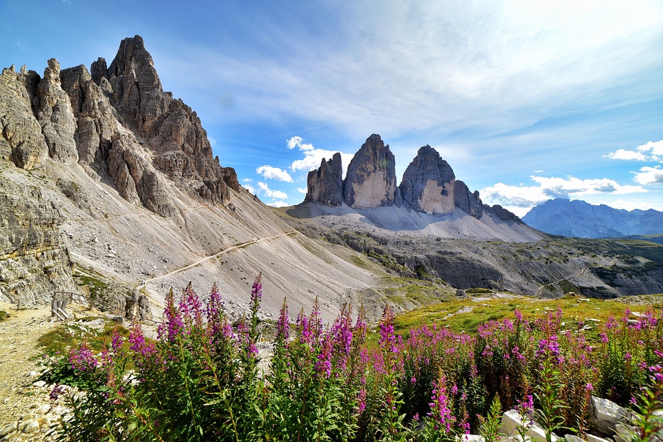
As far as mountain treks go, it doesn’t get better than the Tre Cime di Lavaredo.
Three massive rocky towers rise up from the rolling scenery of the Dolomites, with meadows, lakes, spruce forests and wildflowers.
Located in a nature reserve, this trail is relatively easy and can be walked by families and amateurs.
The trail makes its way to Rifugio Lavaredo, then climbs up to Forcella di Lavaredo with pop-up views of the Tre Cime – a trilogy of photogenic peaks, before heading on to Rifugio Locatelli and back to Rifugio Auronzo.
Hit the trail early in the morning to have a slice of paradise all to yourself.
Selvaggio Blu, Sardinia

Photo: Facebook
Start: Pedra Longa
End: Cala Fuili
Length: 45 kilometres
Duration: four to seven days
Difficulty: very difficult
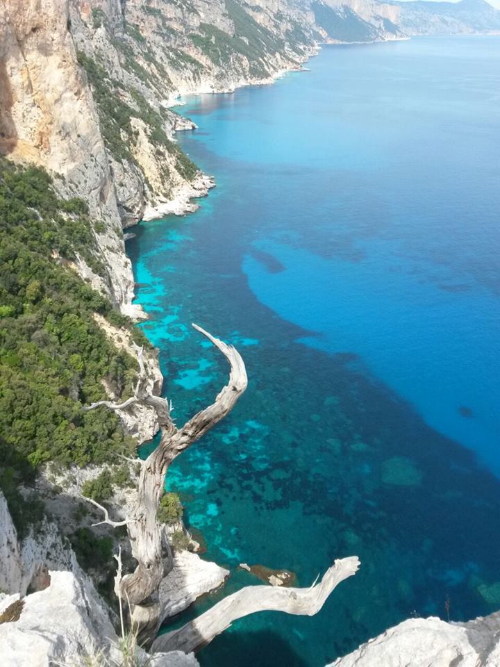
Known widely as Italy’s toughest trek, the Selvaggio Blu, or the Wild Blue, is no walk in the park.
Situated along the Golfo di Orosei on Sardinia’s east coast, this is an ambitious trek that requires mountaineering experience.
But just because it’s tough doesn’t mean it’s not worth it.
The multi-day hike allows trekkers to explore one of Italy’s wildest and most isolated coastlines, with deep gorges, dense vegetation, centuries-old oak woods, cliffs dipping up to 800 metres and stunning views of the Mediterranean.
If you’re unfamiliar with the area, you’ll need to hire a local guide before you get going.
Sentiero degli Dei, Amalfi Coast

Photo: Facebook
Start: Positano
End: Praiano
Length: eight kilometres
Duration: four to five hours
Difficulty: easy-moderate
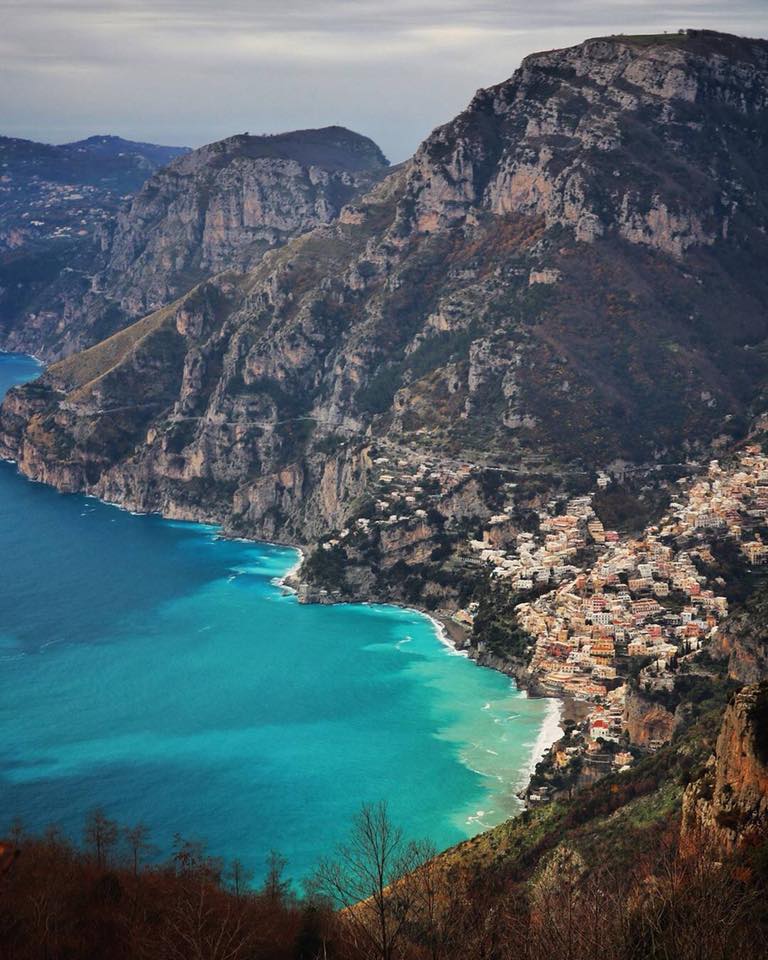
The Sentiero degli Dei, or Path of the Gods, is heaven on earth with its stunning scenery and breathtaking views of the rugged, densely wooded Lattari mountains that plunge down to the Mediterranean.
This path has been wandered by pilgrims and shepherds since darkest antiquity and will transport you to another realm.
Hikers pass terraced hillsides, lemon and orange orchards and rosemary and holm oaks.
A flight of 1500 steps take visitors down to Arienzo, where they can stop for a refreshing dip.
Some of the climbs are quite strenuous, but much of the walking is moderate and offers dramatic and sometimes vertiginous views.
Pack a picnic, grab a map of the trail and prepare for an otherworldly experience!
Corno Grande, Abruzzo

Photo: Facebook
Start/End: Main car park at Campo Imperatore
Length: nine kilometres
Duration: five to seven hours
Difficulty: moderate (normal route), difficult (direct route)
Corno Grande, or Big Horn, is the highest point in the Apennines, standing at 2192 metres.
Depending on the season, the slopes are covered in snow or lush grass and colourful wildflowers.
The normal route is an easy climb to the summit, where visitors can take in mesmerising views of the rippling mountain range, the Adriatic Sea and glimpses of Europe’s southernmost glacier, the Calderone.
Experienced trekkers can choose the alternative route that zigzags directly to the summit.


